

Airports Plus app for iPhone and iPad
Developer: Alexander Flohr
First release : 24 Jan 2012
App size: 148.75 Mb
Airports plus includes an offline database of thousands of multi-detail world airports for high speed search in flight and on the ground.
Airports plus is universal: One purchase allows the use of Airports plus on both your iPhone/iPod touch AND on the iPad, optimized for HD split screen graphics, including satellite and regular maps.
Search by IATA, ICAO, Name, City or a combination of any. A list of search results appears while you type. Store your favorites in a separate list and add your personal notes to each individual airport. Backup your notes or share with other users.
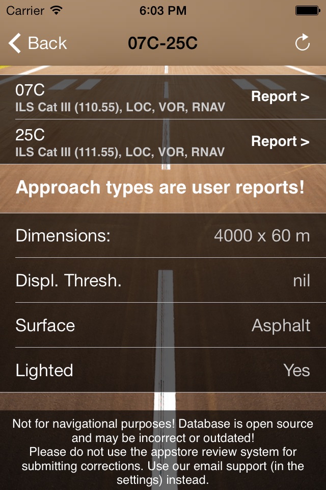
User maintained database of approach types. Add and correct approaches to any runway and help growing the best approaches collection on iOs.Your contributions will go live for all users to see instantly.
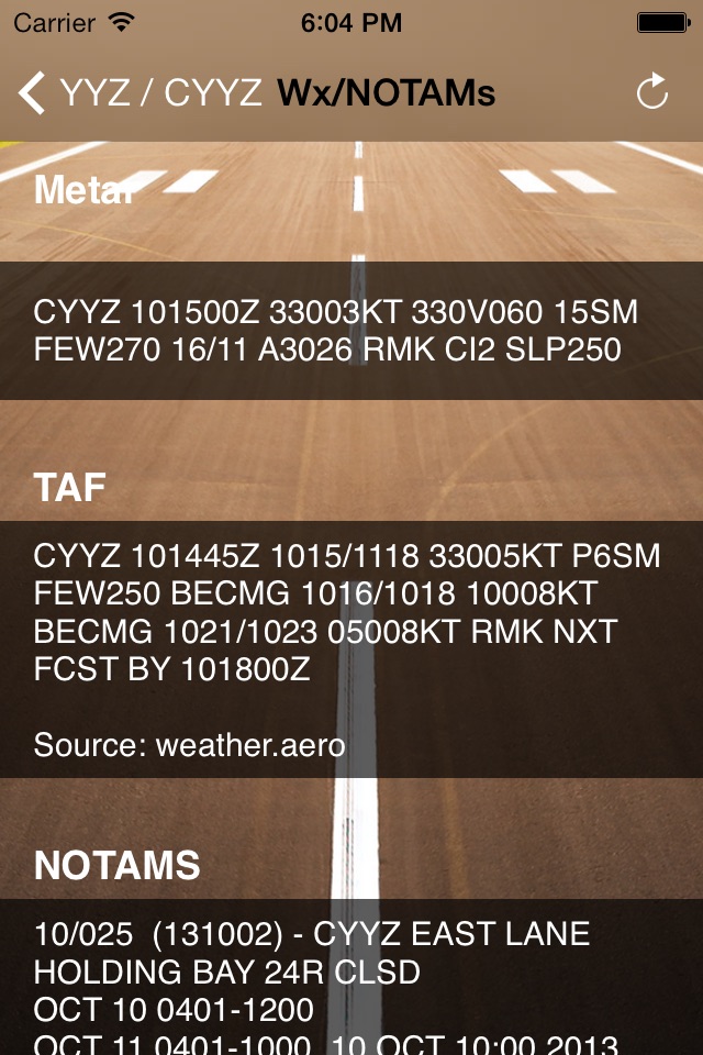
One-click current weather information (METAR/TAF) as well as VOLMET stations (VHF and HF) worldwide
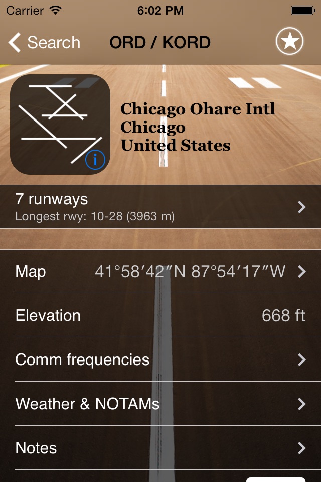
Airport information includes:
- Runway layout (offline & fullscreen)
- Coordinates
- Elevation
- Timezone reference to UTC (winter and summer)
- quick indication of the longest runway available
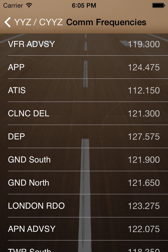
A list of most common radio frequencies including:
- ATIS
- Approach
- Director
- Ground
- Tower
- De-icing
…and others
A list of all runways including:
- dimensions (length and width) in feet or meters
- information on displaced thresholds
- Runway Heading
- Surface
- Lighting
Provided internet connection:
- receive most current weather information instantly (METAR and TAF)
- display airport on a fullscreen map. Choose from
- satellite
- standard map
- hybrid
Please note: Like all comparable airport apps, airport data is taken from open source databases and may not be up to date, eventhough frequent updates are provided.